
Independent UK road reporting
See it.Report it.Change it.
Report a pothole in under a minute. Add a photo, pin it on the map and follow it from report to repair. Every report helps build a clearer picture of road conditions across the UK.

Last updated: 21 Oct 2026, 12:31
How it works
Three steps. Under a minute.
1 Take a photo
Capture the defect safely from the pavement. Never stop in traffic to take a picture.
2 Add the location
Use your current location or drop a pin. We find the road, postcode and likely highway authority.
3 Submit your report
Get a reference number instantly and track progress from review to referral and repair.
Live map
Open full map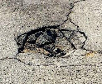
Safer roads
Clear, located evidence helps prioritise the defects that put cyclists, motorcyclists and drivers at risk.
Clear referrals
Reviewed reports are referred to the right highway authority, identified from official postcode and boundary data.
Stronger communities
Confirm reports you have seen too. Shared evidence shows where problems persist.
Open data
Reports by highway authority
Authorities are identified from location data and may not reflect every local arrangement. Figures cover reports made on this platform only.
| Highway authority | Open | Repaired | Total |
|---|---|---|---|
| Trafford Council | 1 | 0 | 1 |
| Birmingham Council | 1 | 0 | 1 |
| Manchester Council | 1 | 0 | 1 |
| Oldham Council | 1 | 0 | 1 |
| Glasgow City Council | 1 | 0 | 1 |
| Liverpool Council | 1 | 0 | 1 |
| City of Edinburgh Council | 1 | 0 | 1 |
| Salford Council | 1 | 0 | 1 |
Spotted a pothole today?
Report today. A smoother tomorrow.